We are a company with an experience of over 18 years in the field of Photogrammetry & Photogrammetric Mapping. We pride ourselves on having been making 3D precision maps for our clients abroad and in India these past years. We are a premiere company in compilation, data capture, data processing and we make certain that we deliver high quality data without compromising our project deadlines.
Welcome to
Geo Resource Mapping Pvt. Ltd.
We bring the third dimension to mapping by using aerial photography to create three dimensional (3D) maps that are accurate, easy to read & make designing a breeze!
A LITTLE BIT ABOUT US
WE ARE SKILLED
We have ample experience in Photogrammetric mapping in line with US mapping standards with precision, accuracy & aesthetics.
WE ARE TRAINED
We have managers who have been trained in USA as per ASPRS, County & DOT standards & experienced compilers having had one-on-one training to learn their craft in making maps.
WE ARE PROFESSIONAL
We ensure that the maps are of the highest accuracy & quality while also taking care of project deadlines. We have dedicated QA & QC teams to verify that our maps are of top quality.
OUR JOURNEY
We’ve been delivering awesome maps since 2003. Over the past 18 years, the capabilities of the company have grown from just making maps to flying drones, running ground surveys, triangulating projects, generating orthophotos, making incredible videos and much more.
We have specialised in creating three dimensional (3D) maps using aerial photographs and ground control which provide a huge amount of help to architects, engineers and designers. Then to take it up a notch, we bought our own drones, learnt to fly them and started taking high-definition photographs with them. With our background in Photogrammetry, we not only triangulated the images, but this led to high accuracy maps with precision contours as well as all visible planimetric features and our clients in India became very happy with them.
We also created high-definition Orthophotos, which are basically visual maps, overlaid the vector data on top of it which is pleasing the engineers & designers as they can see the land as it is today without having to step out of the office. We have incorporated the capabilities of Lidar mapping. We classify Lidar data, capture data, clean up the dense matrix of points to make clean maps with accurate contours.
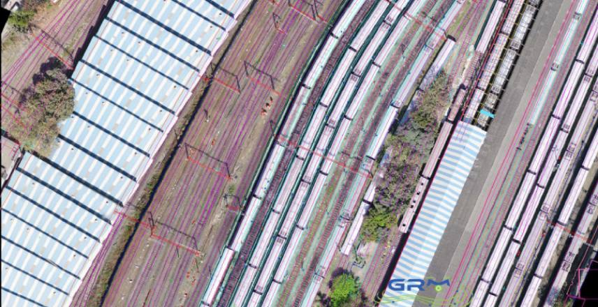
We have executed over 3,000 projects for our clients in USA, Europe & India in diverse fields such as land development, town planning, road & infrastructure development, golf course development, utility layout designing, landfill estimation, volumetric calculation as well as railroad mapping.
In India, we conduct ground surveys (Total-Station & DGPS), fly multi-rotor drones (UAV) and take high resolution photos and videos.
CLIENTS TALK

"I have known and worked with Yogesh Pantsachiv and the guys at Geo Resource since 2000, over 20 years. This company is professional, provides excellent service and quality products. I would not hesitate to recommend them. They have produced topographic & planimetric data from aerial imagery and LiDAR products directly for me and also digital orthophoto products."
Scott Williams

"When we need help we call Yogesh & company. The manpower effort required on some of our projects is unavoidable and we depend on their professional attitude, high quality product and fast production schedules."
Mal Content

"Having worked with the GRM team for many years, I happily recommend their services. They produce good quality, accurate work in a timely fashion and are a pleasure to deal with."
"Having worked with the GRM team for many years, I happily recommend their services. They produce good quality, accurate work in a timely fashion and are a pleasure to deal with."
Jane Smith
A WIDE RANGE OF SKILLS
MAV and UAV Data Processing
- MAV (Manned Aerial Vehicle)
- Large & medium format cameras
- Analogue cameras
- Multi spectral cameras
- UAV (Unmanned Aerial Vehicle)
- DJI/Sony sensors
- Multi spectral cameras
- Thermal & custom cameras
Photogrammetric
Mapping
- Analytical Aerial Triangulation
- Stereoscopic 3D Compilation
- DTM
- Plan
- CAD Cleanup
- Orthophoto generation and Mosaicking
- Volume Computation and Cross Sections
Lidar Mapping (Lidargrammetry)
- Mosaicking, Noise Reduction
- Data Capture and Classification
- DEM, DTM, DSM
- Volume Computation and Cross Sections
3D Modeling – (From 3D Laser Scanning)
- Power
- Construction
- Oil and Gas
State of the
Art Infrastructure
- 24 Stereoscopic Photogrammetric Workstations
- Backup Servers
- Firewall
- Highspeed Internet
- Professional staff Comprises of Surveyors, Drone Pilots Photogrammetrists, Architects and Civil Engineers
Software
Licenses
- Vr Mapping Suite
- VrAT, VrOne, VrTwo, VrLidar, VrOrtho-Mosaic, VrDSM
- Autodesk
- Autocad, Map, Civil 3D, Revit, Navisworks, Infra-works
- Inpho
- Orthomaster, Orthovista
- Drone
- Agisoft Professional, Pix4D Mapper, Global Mapper etc.
- Adobe
- Photoshop, Lightroom
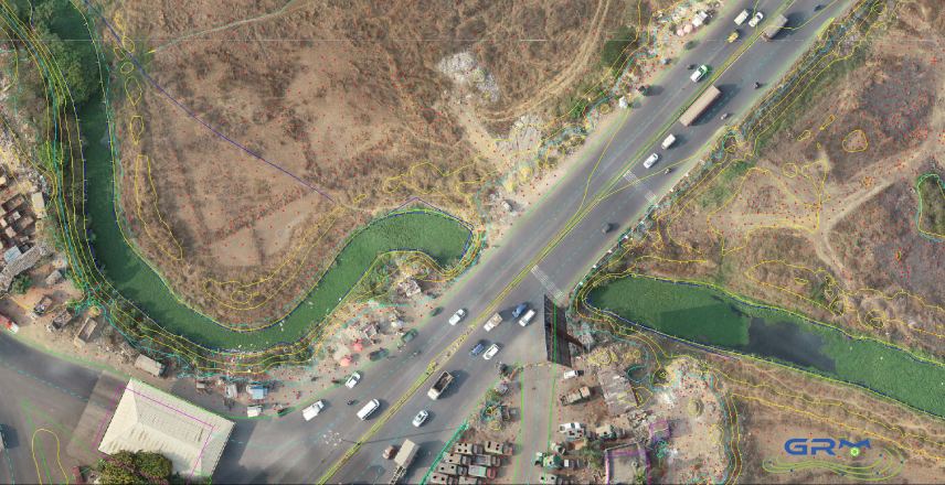
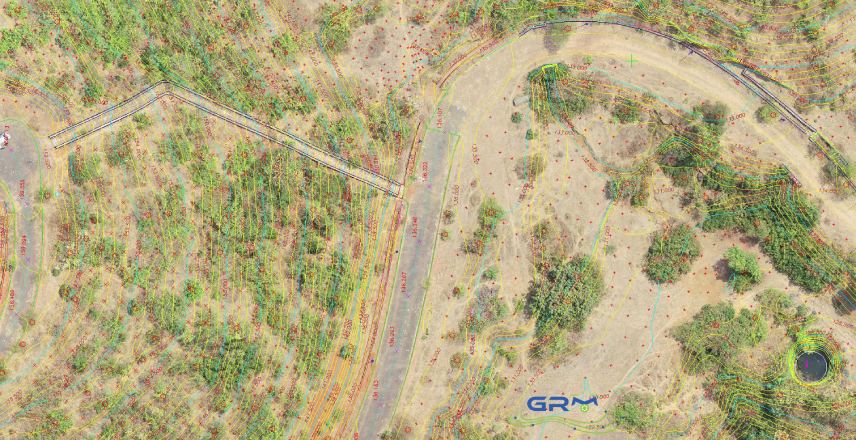
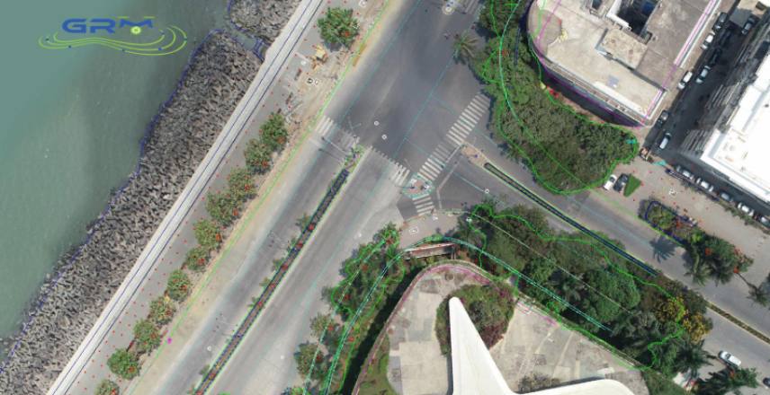
GALLERY

Contact us at info@geomapres.com